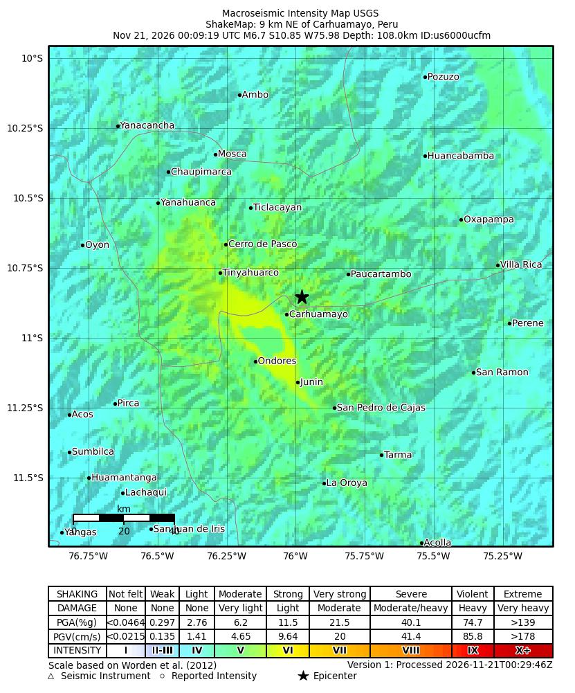
Estimated shaking intensity for the magnitude 6.7 earthquake, 9 km NE of Carhuamayo, Peru, from the USGS ShakeMap. Colors show the strength of shaking, from weak (blue) to violent (red). Map: U.S. Geological Survey
The U.S. Geological Survey reported a magnitude 6.7 earthquake near Carhuamayo, Peru.
The quake struck at 00:09 UTC on Nov. 21, 2026, according to the U.S. Geological Survey (USGS). USGS located the epicenter 9 kilometers northeast of Carhuamayo at a depth of 107.991 kilometers.
USGS event summary: Carhuamayo, Peru earthquake
Detail
Value
Magnitude
6.7
Time (UTC)
2026-11-21 00:09 UTC
Location
9 km NE of Carhuamayo, Peru
Depth (km)
107.991
Latitude
-10.8548
Longitude
-75.9779
Tsunami flag
yes
Felt reports
16
Status
reviewed
Source: U.S. Geological Survey.
USGS listed a tsunami flag as yes. The agency said this flag shows the event occurred in a region where tsunami information is issued and does not mean a tsunami happened.
USGS recorded 16 felt reports for the event. The agency marked the status as reviewed.
USGS provided the coordinates as latitude -10.8548 and longitude -75.9779. The event summary notes that the PAGER alert level is the agency’s estimate of potential impact, using green, yellow, orange, and red categories. The summary did not list a specific PAGER level for this event.