Every article on this site is written by AI from official sources and checked by a second AI. How it works

USGS reports magnitude 6.8 quake near Timor Leste

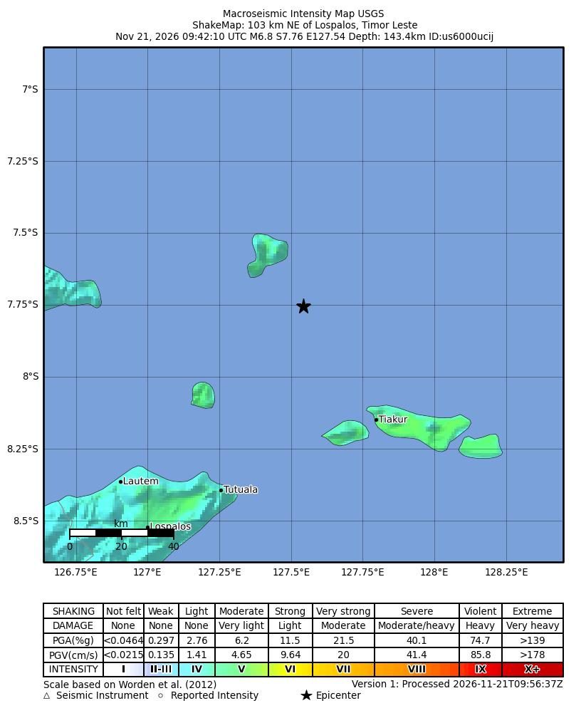
Map of estimated shaking intensity for the magnitude 6.8 earthquake near 103 km NE of Lospalos, Timor Leste
Estimated shaking intensity for the magnitude 6.8 earthquake, 103 km NE of Lospalos, Timor Leste, from the USGS ShakeMap. Colors show the strength of shaking, from weak (blue) to violent (red). Map: U.S. Geological Survey

The U.S. Geological Survey reported a magnitude 6.8 earthquake 103 kilometers northeast of Lospalos, Timor Leste. The agency listed the time as 09:42 UTC on Nov. 21, 2026, and the depth as 143.423 kilometers.

The event page gave the location as latitude -7.7563 and longitude 127.5428. The tsunami flag for the event was marked “no,” according to the U.S. Geological Survey.

USGS event details
ItemValue
Magnitude6.8
Time (UTC)2026-11-21 09:42
Depth143.423 km
Location103 km NE of Lospalos, Timor Leste
Latitude-7.7563
Longitude127.5428
Tsunami flagno
Statusreviewed
Source: U.S. Geological Survey.

The agency said on the page that the tsunami flag shows only whether the area is one where tsunami information is provided. It said the flag does not mean a tsunami occurred.

The U.S. Geological Survey marked the event status as reviewed. The summary did not include information on damage, injuries, or felt reports.

The page also described the PAGER alert level as the agency’s estimate of potential impact, listed as green, yellow, orange, or red. The summary did not state a PAGER alert level for this event.

The U.S. Geological Survey identified Lospalos, Timor Leste, as the reference city and placed the epicenter 103 kilometers to its northeast. All figures and details were published on the agency’s official event summary page.
  1. M 6.8 - 103 km NE of Lospalos, Timor Leste — U.S. Geological Survey
How this article was made
Written with
GPT-5 (OpenAI)
Fact-checked by
Gemini 3.1 Pro (Google) — passed
Generated
Nov. 21, 2026, 5:09 a.m. ET
Sources used
1 official source, listed above
Photo
Map: U.S. Geological Survey, from the official source page (U.S. government work, public domain)
Article type
Standard

The AI wrote only from the sources listed. No human reporter was involved. Read our standards or compare the models in the AI Report Card.