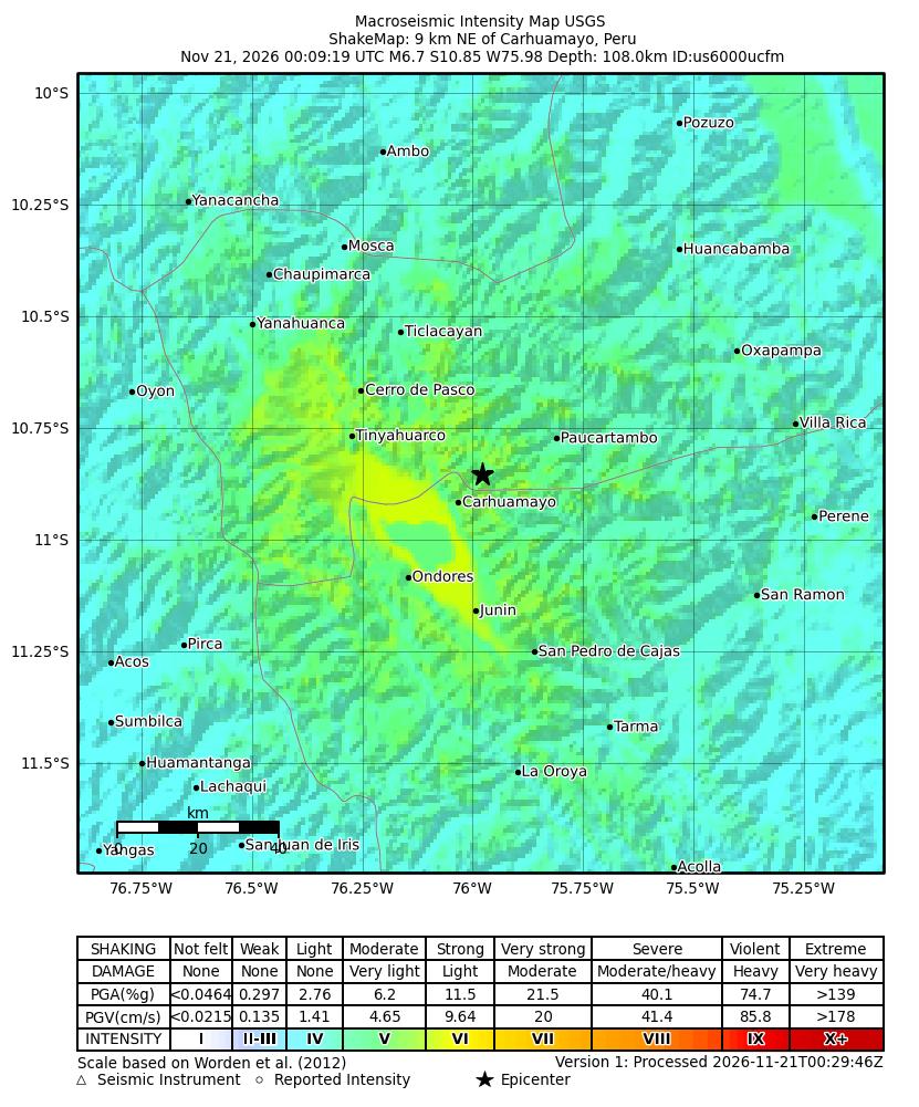
Estimated shaking intensity for the magnitude 6.9 earthquake, 22 km WNW of Ondores, Peru, from the USGS ShakeMap. Colors show the strength of shaking, from weak (blue) to violent (red). Map: U.S. Geological Survey
The U.S. Geological Survey reported a magnitude 6.9 earthquake 22 km west-northwest of Ondores, Peru.
The agency listed the time as 2026-11-21 00:09 UTC. USGS reported a depth of 142.1 km. The event’s coordinates were latitude -10.98 and longitude -76.319, according to the agency.
USGS event summary for Ondores, Peru earthquake
Field
Value
Magnitude
6.9
Location
22 km WNW of Ondores, Peru
Time (UTC)
2026-11-21 00:09 UTC
Depth
142.1 km
Latitude
-10.98
Longitude
-76.319
Tsunami flag
yes
Status
REVIEWED
Source: U.S. Geological Survey.
USGS marked the tsunami flag as yes. The page explains that the flag only shows the event is in a region where tsunami information is issued and does not mean a tsunami occurred. The status was listed as reviewed. The summary did not state a PAGER alert level.